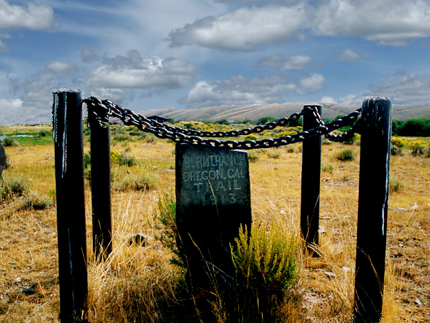
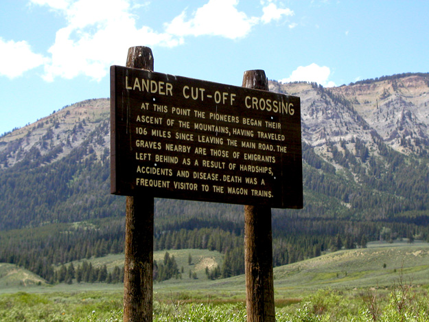
Congress passed the Pacific Wagon Road Act in 1857. The first wagon road to receive congressional funding was the Lander Trail section of the Fort Kearney, South Pass, and Honey Lake Wagon Road. With the goal of improving the Oregon-California Trail system, the Lander Trail (Cut-Off) left the Oregon-California trail east of South Pass near the Ninth Crossing of the Sweetwater. The area around the Ninth Crossing of the Sweetwater is referred to as Burnt Ranch…Indians burned the ranch buildings in 1868. At various times, Gilbert’s Station, Upper Sweetwater Station, South Pass Station, Pony Express Station, South Pass Mail Station, and a Mormon Mail Station were all located in this general area. Today, hikers and campers can still travel parts of the trail, but a lot of it is privately owned. You must arrange for permission to go on the Burnt Fork Ranch.
Burnt Ranch
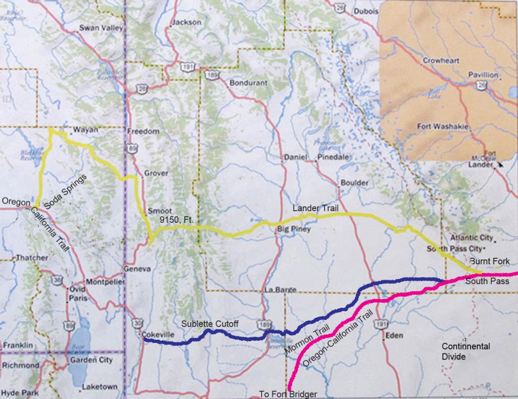
The Lander Trail rejoined the Oregon-California Trail a few miles west of Soda Springs near Chesterfield, Idaho…for ease of following the Lander Trail modern day names are used.
Lander Sublette Cutoffs Oregon Mormon Trail
The chief engineer Frederick W. Lander surveyed the route in 1857. Construction on the Lander Cut-Off was started in 1858 with fifteen engineers and one hundred and fifteen men. One year (1857) after the Mountain Meadow Massacre in Southern Utah, many believed construction of the Lander Cut-Off was intended to provide a route that avoided the Mormon settlements in the Utah Territory. However, the majority of the laborers hired to build the Lander Trail were Mormons from the Salt Lake Valley.
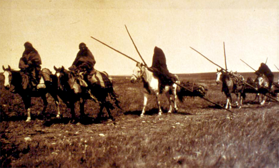
The Lander Cut-Off was constructed in less than 90 days at a cost of $67,873. Lander’s workers moved roughly 62,000 cubic yards of dirt, built 7 bridges, and cut a trail across three mountain ranges. The road was completed ahead of schedule and at a lower cost than expected…a reason for the fast construction time was a good portion of the Lander Trail followed wide Indian travois trails.
Indian Travois Trail ~ 6 feet wide
The 227 mile Lander Trail shortened the Oregon-California Trail by approximately 80 miles and seven days of travel. An advantage to the Lander Trail was good grass, water, and firewood…a disadvantage was a steeper, rougher trail. To promote the new Lander Cutoff trail, Frederick Lander published a 1,000 copies of a Lander Trail Guide.
The Lander Cutoff departed from the Mormon and Oregon-California trails 8 miles east of South Pass near the Ninth Crossing of the Sweetwater River. The Lander Trail continued along the Sweetwater River to the Continental Divide then west to Buckskin Crossing on the Big Sandy River.
Continuing on west, the Lander Trail crossed the Green River near Big Piney, Wyoming. From there the trail followed North Piney Creek and then crossed over a low divide (Thompson Pass) to South Piney Creek.
Wyoming Range of the Rocky Mountains
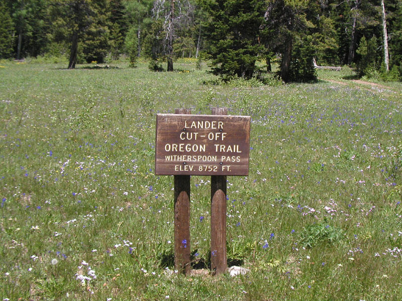
The Lander Trail proceeded west up South Piney Creek before passing over the 8,752 foot Witherspoon Pass in the Wyoming Range.
Witherspoon Pass
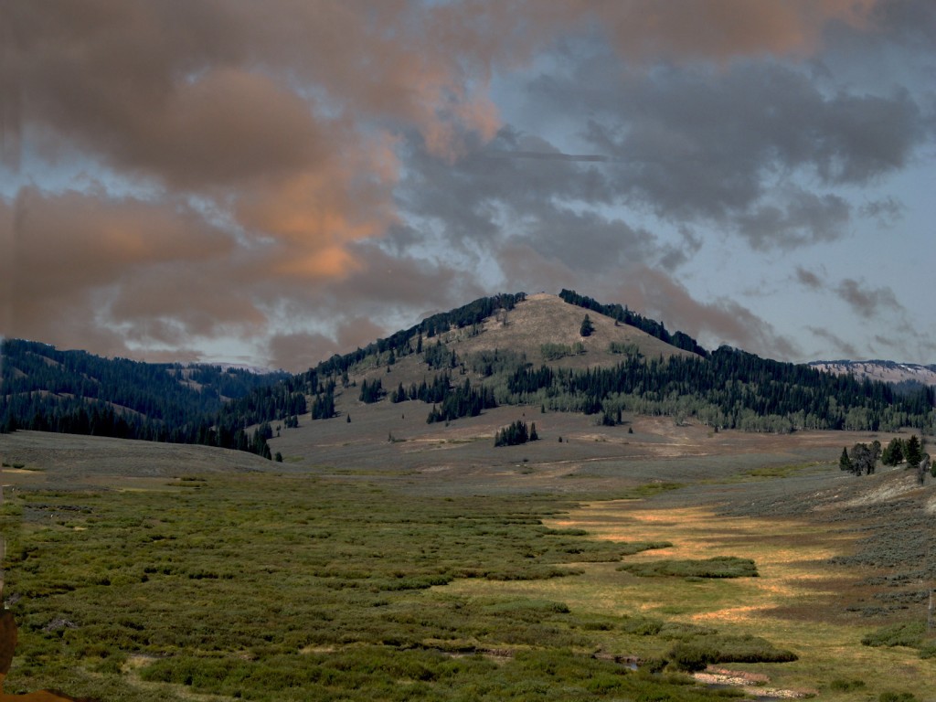
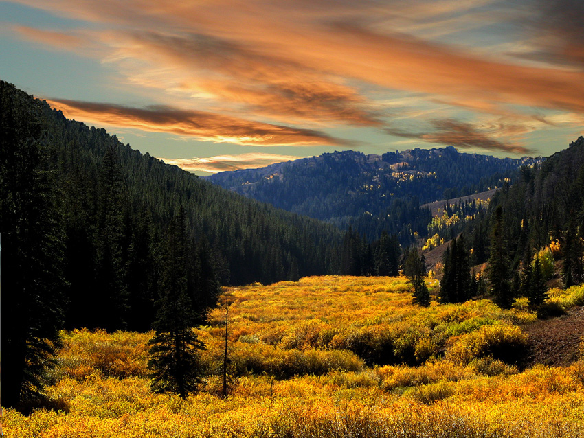
From Witherspoon Pass, the Lander Cutoff dropped down onto La Barge Creek and followed it to the La Barge meadows.
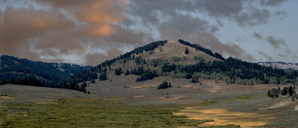
Sunrise on the La Barge Meadows
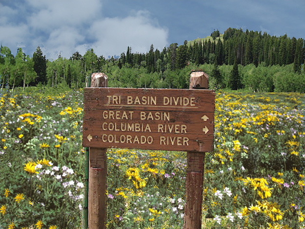
At the west end of the La Barge meadows is the Tri Basin Divide. On the southeast side, La Barge Creek flows into the Green-Colorado river drainage. On the north, Greys River flows into the Snake-Columbia rivers. West of the Tri Basin Divide, Smiths Fork flows into Bear River and on to Great Salt Lake in the Great Basin.
Tri -Divide
From La Barge Ranger Station, the Lander Trail crossed over Wagner Pass on the south end of Commissary Ridge to Hobble Creek. After following Hobble Creek for a little over a mile, the Lander Trail crossed the divide separating the North Fork of Hobble Creek and Smiths Fork. Crossing this divide is the highest point on the Lander Trail, 9150 ft.
Smiths Fork CanyonSmiths Fork – Lander Trail
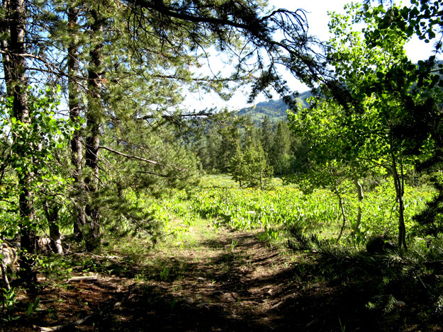
One and a half mile above where the Smiths Fork Road joined US Highway 89, the Lander Trail left the Smiths Fork Road and goes straight north into Star Valley.
Star Valley Wyoming
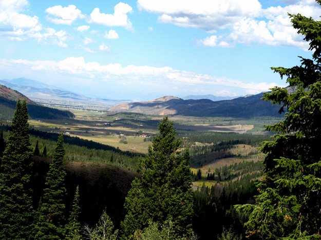
The Lander Trail continued north along the Wyoming-Idaho border of Star Valley. After going about 20 mile north, the Lander Cut-Off turned due west and entered Idaho along Stump Creek. Four miles up Stump Creek, the Lander Trail turned north into Stump Creek Canyon (Smoky Creek Canyon).
A short ways up Stump Creek, huge deposits of salt were on the west side of Stump Creek…Indians, mountain men, pioneers, and the Oneida Salt Works used these salt deposits. Between 1866 and 1880 wagon trains hauled salt to the Montana gold mines.
Stump Creek Salt Deposits
The Lander Trail continued up Stump Creek to Terrace Canyon. At Terrace Canyon, the Lander Cutoff turned west to the Grays Lake Valley. Proceeding past the south end of Grays Lake, the Lander Trail followed Highway 34 to US Highway 30 near Soda Springs, Idaho. Basically, US Highway 30 follows the wagon ruts of the Oregon-California Trail to the Raft River in Idaho. From here the California Trail goes to California, while the Oregon Trail goes to the Oregon Country.
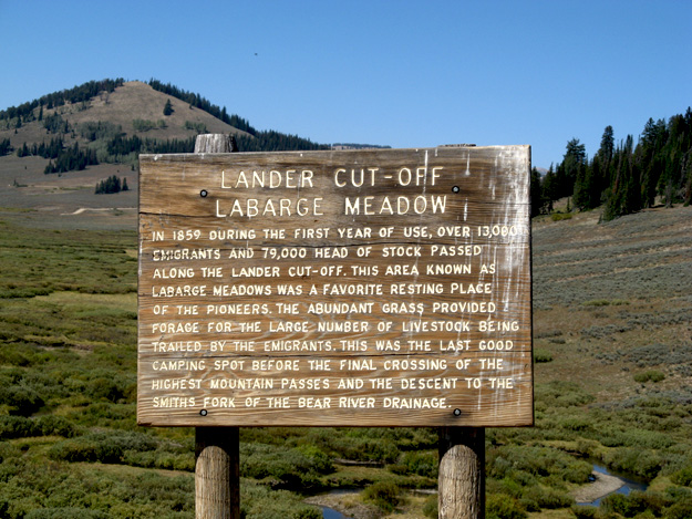
In 1859, 13,000 emigrants with 79,000 head of livestock traveled over the Lander Cut-Off.Records after 1859 are lacking, and its use after 1859 are assumed to sharply decrease, but this is not supported by some pioneer journals. Some historians estimate 100,000 pioneers used the Lander Trail between 1859 and 1869, but with two other choices…the Fort Bridger route and the Sublette Cutoff…the 100,000 figure might be high.
Many internet sites refer to the Lander Trail going to Fort Hall, but there is little evidence for this. Fort Hall was several miles north and west of the Oregon-California Trail, and with the Hudson’s Bay Company abandoning Fort Hall in 1856, there was little reason to go to Fort Hall in 1859. IDAHO STATE HISTORICAL SOCIETY REFERENCE SERIES FORT HALL Number 121 January 1968, stated:
…the great Snake River floods damaged Fort Hall severely in 1853, and much of the emigrant traffic bypassed Fort Hall, the British company hoped to continue to supply travelers on the Oregon Trail. Wagons began to haul flour and trade goods from the Lower Columbia to Fort Hall in 1853, and pack trains were discontinued altogether on the supply route in 1854. Indian trouble along the Oregon Trail broke out near Fort Boise in 1854, however, and by 1856 the situation deteriorated so terribly that Fort Hall had to be withdrawn.
A factor in the decline of the western emigrant trail use was the completion of the first transcontinental railroad in 1869. The railroad provided cheaper, faster, and safer travel west…the journey took seven days and cost as little as $65. The Lander Trail was still used after the railroad, but primarily for a different reason. Between 1875 and 1890, drovers herded vast numbers of cattle and horses from Oregon to Wyoming. The livestock went primarily to large ranches in the Green River and Bighorn basins.
The Lander Trail article was written by Ned Eddins of Afton, Wyoming.
Permission is given for material from this site to be used for school research papers.
This site is maintained through the sale of my two historical novels. There are no banner adds, no pop up adds, or other advertising, except my books — To keep the site this way, your support is appreciated.
There have been many requests for copies of pictures from the website. The best website pictures, and others from Jackson Hole, Yellowstone, and Star Valley, Wyoming, have been put on a CD. The pictures make beautiful screensavers, or can be used as a slide show in Windows XP. When ordering Mountains of Stone, request the CD and I will send it free with the book. The Winds of Change CD contains different pictures than those on the Mountains of Stone CD. To view a representative sample of the pictures on the CDs, click on…
To email a comment, a question, or a suggestion click on Mountain Man.
To return to the Home Page click on the Fur Trapper logo.